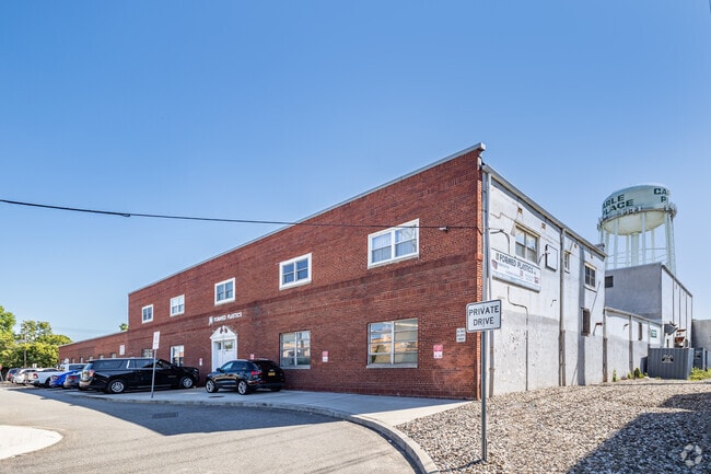
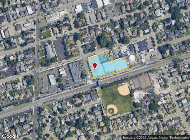
Property Record
215 Stonehinge Ln, Carle Place, NY 11514
NEARBY LISTINGS FOR SALE OR LEASE
Property Detail
215 Stonehinge Ln
2289-10-032-00-0001-0
1-12,43-52
Industrialgeneral
Nassau
X
New York
36059C0226G
1
2025
1.26 AC
2025
Central Nassau
303800
Long Island (New York)
74,575 SF
Nassau County-Suffolk County, NY
DEMOGRAPHICS near 215 Stonehinge Ln
1 Mile
3 Mile
5 Mile
2024 Total Population
15,456
153,395
442,964
2029 Population
15,226
150,849
435,563
Pop Growth 2024-2029
(1.49%)
(1.66%)
(1.67%)
Average Age
45
41
41
2024 Total Households
5,917
48,499
136,260
HH Growth 2024-2029
(1.30%)
(1.60%)
(1.71%)
Median Household Inc
$118,124
$115,213
$124,536
Avg Household Size
2.50
2.90
3.10
2024 Avg HH Vehicles
2.00
2.00
2.00
Median Home Value
$692,022
$680,516
$679,414
Median Year Built
1957
1955
1954
Nearby Places
- Restaurants
- Banks
- Shops
- Fitness
- Groceries
PUBLIC TRANSPORTATION
COMMUTER RAIL
Carle Place Station (Port Jefferson Branch - Long Island Rail Road)
DRIVE
WALK
Distance
Carle Place Station (Port Jefferson Branch - Long Island Rail Road)
0 min
5 min
0.0 mi
Westbury Station (Port Jefferson Branch - Long Island Rail Road)
DRIVE
WALK
Distance
Westbury Station (Port Jefferson Branch - Long Island Rail Road)
2 min
1.3 mi
AIRPORT
John F Kennedy International
DRIVE
WALK
Distance
John F Kennedy International
28 min
16.9 mi
LaGuardia
DRIVE
WALK
Distance
LaGuardia
30 min
18.8 mi
Westchester County
DRIVE
WALK
Distance
Westchester County
60 min
39.4 mi
Freight Ports
NY - Red Hook Container Terminal
DRIVE
WALK
Distance
NY - Red Hook Container Terminal
41 min
26.9 mi
Nearby Properties
Address
Land Use
TOTAL SIZE
Lot Size
Zoning
Address
Land Use
TOTAL SIZE
Lot Size
Zoning
5,322,666 SF
86.10 AC
Address
Land Use
TOTAL SIZE
Lot Size
Zoning
419,282 SF
57.46 AC
Address
Land Use
TOTAL SIZE
Lot Size
Zoning
187,225 SF
15.35 AC
Address
Land Use
TOTAL SIZE
Lot Size
Zoning
1,188,742 SF
11.93 AC
Address
Land Use
TOTAL SIZE
Lot Size
Zoning
181,472 SF
168.80 AC
Address
Land Use
TOTAL SIZE
Lot Size
Zoning
2,835 SF
239 AC
Address
Land Use
TOTAL SIZE
Lot Size
Zoning
556,575 SF
11.46 AC
Address
Land Use
TOTAL SIZE
Lot Size
Zoning
170,920 SF
27.82 AC
Address
Land Use
TOTAL SIZE
Lot Size
Zoning
Address
Land Use
TOTAL SIZE
Lot Size
Zoning
6,120 SF
226.22 AC
Address
Land Use
TOTAL SIZE
Lot Size
Zoning
822,113 SF
26 AC
Address
Land Use
TOTAL SIZE
Lot Size
Zoning
568,086 SF
21.99 AC
Address
Land Use
TOTAL SIZE
Lot Size
Zoning
962,971 SF
18.90 AC
Address
Land Use
TOTAL SIZE
Lot Size
Zoning
493,535 SF
5.88 AC
Address
Land Use
TOTAL SIZE
Lot Size
Zoning
352,730 SF
41.04 AC
Address
Land Use
TOTAL SIZE
Lot Size
Zoning
29,224 SF
1.33 AC
Address
Land Use
TOTAL SIZE
Lot Size
Zoning
277,200 SF
21.03 AC
Address
Land Use
TOTAL SIZE
Lot Size
Zoning
111,756 SF
21.24 AC
Address
Land Use
TOTAL SIZE
Lot Size
Zoning
63,600 SF
2 AC
Address
Land Use
TOTAL SIZE
Lot Size
Zoning
182,129 SF
1.51 AC
Address
Land Use
TOTAL SIZE
Lot Size
Zoning
92,466 SF
8 AC
Address
Land Use
TOTAL SIZE
Lot Size
Zoning
152,783 SF
51.20 AC
Address
Land Use
TOTAL SIZE
Lot Size
Zoning
254,845 SF
22.28 AC
Address
Land Use
TOTAL SIZE
Lot Size
Zoning
399,955 SF
13.63 AC
Address
Land Use
TOTAL SIZE
Lot Size
Zoning
35,718 SF
22.15 AC
Address
Land Use
TOTAL SIZE
Lot Size
Zoning
252,032 SF
4.72 AC
Address
Land Use
TOTAL SIZE
Lot Size
Zoning
432,954 SF
26.25 AC
Address
Land Use
TOTAL SIZE
Lot Size
Zoning
17,292 SF
60.83 AC
Address
Land Use
TOTAL SIZE
Lot Size
Zoning
80,819 SF
6.90 AC
Address
Land Use
TOTAL SIZE
Lot Size
Zoning
31,828 SF
14.74 AC
The World's #1 Commercial Real Estate Marketplace
Connect with us
© 2025 CoStar Group
The information above has been obtained from sources believed reliable. While we do not doubt its accuracy we have not verified it and make no guarantee, warranty or representation about it. It is your responsibility to independently confirm its accuracy and completeness. Any projections, opinions, assumptions, or estimates used are for example only and do not represent the current or future performance of the property. The value of this transaction to you depends on tax and other factors which should be evaluated by your tax, financial, and legal advisors. You and your advisors should conduct a careful, independent investigation of the property to determine to your satisfaction the suitability of the property for your needs.